
Alex:
 Time
for another big post, because we recently went on a big adventure!
Over spring break (the third week of March this year) Laura and I went
to Hawaii for the first time ever for both of us. We visited The Big
Island because we wanted to see the volcanoes and all the
micro-climates.
Time
for another big post, because we recently went on a big adventure!
Over spring break (the third week of March this year) Laura and I went
to Hawaii for the first time ever for both of us. We visited The Big
Island because we wanted to see the volcanoes and all the
micro-climates.Getting there of course wasn't exactly easy. We managed to keep it down to three flights each way, but it was still a full travel day on each end of the trip. If you go to Hawaii, make sure it's a long trip to make the travel worth it!
We arrived in the dark, but actually had little trouble finding our accommodations for the first half of the trip: the Bamboo Orchid Cottage B&B.
Day 1: Waterfalls, crashing waves, and lava trees

The first morning after we arrived we drove around picking up supplies (PBJ fixings, snacks, water), acclimating to the island, and getting late breakfast in Hilo.
 |
| This tiny pineapple was not breakfast |

We took a short walk up into the forest along the river where there lived this massive Banyan tree growing out and up the hill killing all the other trees it could reach. According to a local it was planted in the early 1900s!


It was a very short walk over to the river above the falls, where we hopped across the rocks for a little bit.


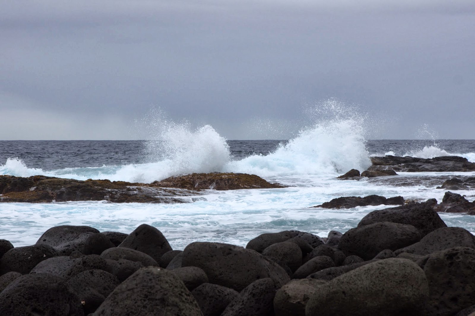
We drove around and saw some more streams and smaller falls and various flowers until we found our way to a little rocky beach area. We stopped here and walked around looking at the waves crashing against the rocks, and had ourselves a PBJ lunch.


We drove down southeast to the tiny Lava Tree State Park. A short path loops through the park, winding between colorful vegetation, deep cracks in the earth, and the lava trees.
 |
| It's hollow! |
The lava trees are the main attraction, and are hollow pillars created by a certain type of tree that held so much moisture it resisted burning long enough to create a mold of solidifying lava.
On some of them you can still see the texture of the bark in the stone of the interior walls.
 |
| This one is medium size |
The lava flows were fast moving enough that most of the rest of the lava flowed away, and so the molds can be pretty tall.
 |
| Unfurling fern fronds |


By the time we left it was getting dark, so we stopped by Hilo for a drink and some pizza at Cafe Pesto (really great food too!) and then headed back to the B&B for the night.
Day 2: Volcanoes and craters

On the second day it was time to see some volcanoes! After a delicious breakfast we headed a couple miles down the road to the Volcanoes National Park. We drove straight through to the top of Kilauea, which was actually a pretty short distance.

At the top of the caldera is museum, with this view. We would come back later at night and see the orange glow of the lava below, but it was too dim and drizzly to get a good picture.
 | |
| Kilauea is not tall compared to Mauna Loa or Mauna Kea, which are nearly two vertical miles higher at their peaks! |
We had to turn around here, as the road circling the caldera was closed due to toxic fumes. If you plan to visit Volcanoes National Park, expect to make your plans as you go. Even the park rangers can only give you a general idea of where to find lava flows, as it changes from day to day.
 |
| These bluffs also look out over the caldera, but it's a little muggy... |
As we headed down from the top, we stopped off at the steam vents, steam bluffs, and sulfur banks.
 |
| This vent was really blasting! |
 |
| A bamboo orchid - the namesake of our B&B |


Hiking just a little ways from the steam bluffs brought us up close with the sulfur banks and some more steam vents.
 |
| Don't look TOO impressed! |
The sulfur stains the rock yellow, and even forms crystals in some of the cracks.
 |
| CRYSTALS!!! |
 |
| It's really not cold, but the steam can get on you and then gets chilly when it evaporates. |
 |
| If you look real close, you can see people down there. |
 |
| Foof playing tour guide and reading from the trail info pamphlet. |


We started in the jungle on the ridge above, walking along the rim of the crater. The jungle thins out closer to the Pu'u Pua'i cinder cone since much of the foliage was burned up by the fountain.
Laura: The trail descends at the far end of the crater, and once you reach the bottom you're now walk along the hardened lava lake. Coming out of the jungle and onto the crater surface is like walking out onto the surface of the moon! So barren compared to the lush jungle.
 |
| Along the upper sections of the lake ridge you can find some of the usual lava flow loving ʻŌhiʻa lehua flowers - great legend associated with these flowers! |
 |
| Lava moustache |
 |
| Foof getting the shot with her new camera |
 |
| Down into the crater we go, toward Pu'u Pua'i first, and then onto the flat lava lake. |
 |
| Laura in front of Pu'u Pua'i |
 |
| And this is the narrow end of the crater |
Eventually we descend until it flattens out. There is one last broken ridge section we pass through before entering the flattest and widest part of the crater. At this point the rock is still hot, steam seeps out of cracks in the rock and there is almost no vegetation.


At the far end of the crater we ascended back up the ridge - a quick but steep trek!
On the way back to the car, we took a short detour to walk through an empty lava tube -- remnants of an underground lava river.
 |
| Entrance to the lava tube |

We exited the tube, climbed back up to our car and continued on our trek toward the ocean down the Chain of Craters road. We paused at a few craters and drove past a few lava flows from the 60's and 70's.
 |
| Once the jungle thinned out, the drive alternated between light forest, grassland, and barren lava flows |
 |
| Did I mention we rented a Jeep? |

 Laura: When we reached the low plateau approaching the ocean, we stopped off to see the petroglyphs. Here there is a mix of recent and ancient markings in the rock. Some symbols recount travel around the island and some groupings serve as "family trees". A lot of the small dots/holes are where umbilical cords are placed to celebrate a birth (some people of Hawaiian ancestry still follow these customs).
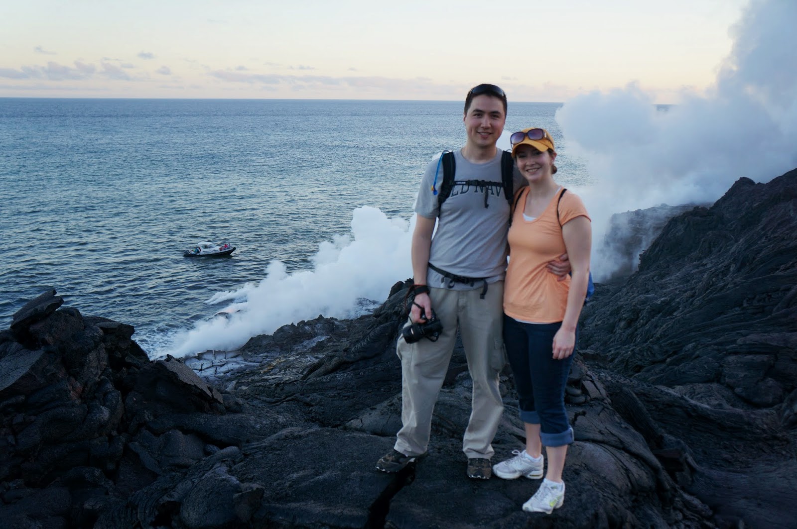
Alex: Finally, we reached the Pacific ocean and the end of the road. I should have noted that this was more about the journey than the destination, because the end of the road is pretty abrupt. The road only ends because lava flowed over it in 1986 and they haven't rebuilt it (the volcano is still erupting, after all).
 |
| Actual flowing lava is several miles past this point, but you can see the steam plume from here (far right in picture) |
 |
| "Road Closed" ...You think? End of the road, and end of our hiking for day 2 |
Day 3: Hot water and hot lava

On our last day on the east side of the island, we had to see some flowing lava. We booked a hiking tour out onto the active lava flow for the late afternoon, so in the morning we headed to Hilo for equipment (hiking pants, flashlights, snorkel gear for later) and then swung down to a hot spring at Ahalanui Park for a quick dip.
 |
| The drive through the rainforest was very pretty |


 |
| Our group was about 8 people plus our guide |
After our visit to the hot spring, we drove down along the ocean to the edge of the lava flow -- opposite where we ended our adventure the previous day. Locals had built a small village & cultural center here on the edge of the flow just outside Kalapana, a town overrun by lava flows over the last couple decades. This is where our tour started, and after covering a mile or two by vehicle along the Chain of Craters road (the other end), we set out on foot.
 |
| Pahoehoe laval -- soup skin! Also, look closely -- smoke on the far left from lava flowing down toward the ocean |
The travel distance on foot was about 3 miles each way. The going was medium speed, as the lava was very uneven, but was so rough it provided decent footing.

You still want to be very careful not to slip, though. The lava is full of silica, and until it is eroded down its surface is like tiny shards of broken glass. Even brushing your hand across it lightly will give you splinters -- I did this accidentally later in the hike and got a nice bleeder in my fingertip.
 |
| Resting partway. Behind me in the distance, a kipuka -- an area surrounded but untouched by the lava, covered with trees |
We found out about this hike from people at breakfast at our B&B, and one of the people in their hike slipped their leg into a lava crack and received hundreds of sharp little keepsakes. And that's why we went out and bought me some hiking pants (see picture, left).

 |
| Lava flowing into the ocean. We're pretty close now. |

The lava under our feet changed consistency as we went along and traveled from decades-old to years-old to days-old flows. At first it was worn down with plants growing in the cracks and a sandy path worn from all the hikers. Then the plants disappeared and it felt crunchier. Then the crunch turned to a surface crispiness and you could feel the heat coming off.
 |
| Our guide checking out the smoke, searching for lava |
Our guide stopped us and pointed out heat waves emanating ahead. He ran up ahead to figure out where the fresh flow was, and when he came back we covered the final 100 yards.
 |
| And there it was |
 |
| And yes, we got VERY close |


This video shows the slow speed of the flow and our close proximity:
The lava crackles and hisses as it cools, and little pieces pop off -- be careful where you step!


Laura: Fun tip! Bring a wire whisk and thick gloves with you on this hike. You can stick the whisk into the hot, flowing lava and take home a nice clump of fresh, primordial earth! Unless of course you're superstitious and believe in the "Curse of the Lava"! Anyone who takes lava rock off the island is destined to have terrible things happen to them when they get home! Mua ha ha ha ha ha! According to our guidebook people mail lava rocks back to the Big Island all the time. Lol.
After checking out the flowing lava for a while (we have a zillion pictures!!!), we made our way to the cliffs overlooking the ocean to see where the lava hits the water - where molten lava is cooled and forms the newest portions of the island.
 |

As the sun set it was finally time to start making our trek back to the village/cultural center...IN THE DARK! It was very strange hiking over the lava without being able to see the horizon or even really knowing how far you've gone. It was so dark!!! Thankfully we had little flashlights to help light up the path, but it was still a bit treacherous hiking over the lava.
It took about an hour or so of slow hiking to get back to the van that would drive us back to the cultural center in Kalapana. Our guide did a great job teaching us about the history of the lava flows and safely navigating the terrain with and without sunlight. Overall, this was an awesome experience, well worth the price, and we would highly recommend this to anyone!
Alex:
Coming soon -- our travels to the Kona side of the Big Island of Hawaii!
Nice documentary you guys. Well written and photographed. I'd like to try that last hike you talked about and see the flowing lava up close.
ReplyDelete